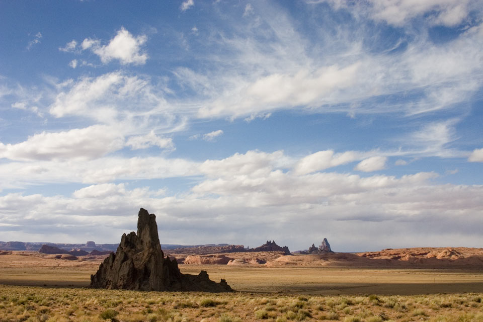
 On the way to Monument Valley, quite close to Kayenta actually, you get to a hill in the highway. Once you crest that hill, you get to see the most amazing sight. On the right, there rises the solidified core of a former volcano ('El Capitan') to a height of almost 300 m above the surrounding plain. The core is the only thing remaining of El Capitan, the rest has eroded away over time. On the left, the remnants of a former butte rise up, looking very much like a statue. But what statue? From various angles it always looks like a different statue. In the middle, there is the lonely highway. Before you ask, no, I'm not scared of standing in the middle of a highway taking a picture. The reason why is simple: you can hear traffic approaching from a long way away.
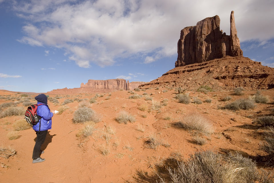 We reach Monument Valley, pay our $10 entrance fee again, that gets me sort of bummed. However, it is still a bargain for the sights you get to see. We sign in at the visitor's centre, supposedly you have to do this before you leave and sign in again after you return. I see that for this year there were only 30 or so entries in the book. We head out, on top was windy and cold, hats, gloves, winter coats are definitely required. Once we get going though, we warm up quite nicely, aided by the fact that the valley floor is well sheltered from the prevailing westerly wind.
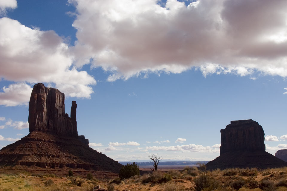

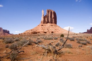
At the outset, a sign tells you what not to do and what to look out for. Don't stray from the trail and do look out for venemous reptiles and insects. I presume they mean snakes and scorpions, but I'm sure these critters won't be out in the cold weather we are facing. The trail itself is moderate to easy and well marked, so getting lost is definitely difficult. The 5 km trail leads around one of the main buttes, called 'West Mitten Butte'. Since nothing but the birds and the wind, as well as the occasional click of the camera shutter may be heard, it makes this extra special to be there next to these giants who
 seem to take on human qualities with their shapes and sizes. The views again are spectacular and it seems like the trail's end arrives sooner than anticipated. We meet no one. I sign out and we leave Monument Valley for other visitors to enjoy.
Having still most of the day ahead of us, we decide to follow Hwy 163 north into Utah, then go east on 162 into Colorado and then take 160 back again to Kayenta for a circle tour. Just north of the Arizona border, in Utah, the views are quite spectacular, especially that of Monument Pass looking back towards Arizona.
However, the rest of the scenery in Utah is awesome as well. One can only wonder what shapes of nature created the landscape, but one thing's for sure: the area was a cauldron at one
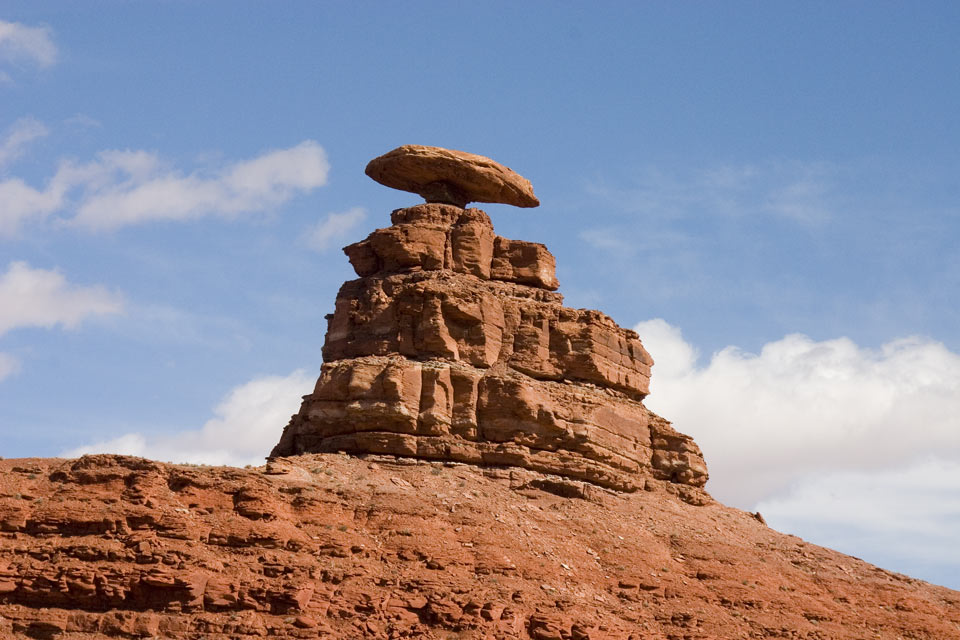 time. When we cross the San Juan River, we come to a place called Mexican Hat and I wonder where did they get that name. Well, it isn't very long before I come around a bend in the road and see this. Puzzle solved. I find a spot in sight of the Mexican Hat, we eat our lunch there, hmm, cucumber sandwiches. After lunch, I decide I must get a shot of the Hat, so I walk across the desert for half a kilometre in order to clear some hydro lines. Take the shot, then walk back again. We drive off, only to clear the next hill and see a driveway right up to the flaming rock. Let me tell you, folks, it doesn't pay to be brainless. On we drive, more spectacular Utahian (sp?) scenery. We try to make it into the Valley of the Gods, but the smallest of creeks flows across the mud access road and I chicken out. Stopped by water. In the desert. Hoodathunk. The terrain gets even wilder with red colors, striations going every which way, then levels off somewhat as we head for the Colorado border. There, we 'hang' a right onto Hwy 160, and proceed on to the Four Corners.
Four Corners is the only place in the US where 4 states meet. At the exact spot is a monument placed by surveyors. The place is wholly contained in Indian Country: The Ute Nation in Colorado, the Navajo in Arizona, New Mexico and Utah. You pay $ 3.00 entrance fee to get near the place and for that you acquire the privilige of visiting hundreds of stalls selling jewelry, blankets and the like.Sort of like Costco, only out of doors. We instead have some Navajo Fry Bread, which tasted yummy, but don't ask me what was in it, flour I presume.
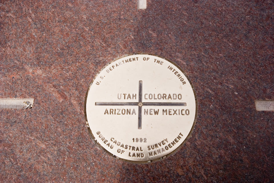
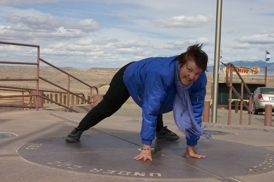 Next of course comes the customary and obligatory photographs. And, by the way, who sez a woman can't be in one place at the same time? I've got the pictures to prove differently: Anne equally divided in four states. I wonder which Sheriff would have to 'bring her in' if they hear the profanities she offers while I take her picture.
By the way, I placed my logger directly on the Monument, and, according to the way I see it, it is in the wrong spot by at least a couple of metres. Pity the poor surveyors who a hundred or more years ago had to run line to get to this point, far away from home and only marginally closer to the nearest saloon.
 We continue our way, now westbound, to Kayenta. Fairly close to Kayenta, I stop for yet another exposed volcano core (there are actually quite a few in this area). Church Rock, it is called. Appropriately enough, it is Sunday.
We reach Kayenta and have to settle for Burger King, since every other restaurant except McDonald's has closed for the evening. Hoodathunk.

 Today's KML file is here
No comments:
Post a Comment